Add your promotional text...
Lecture 17: Water Management Goes High-Tech: AI and Sensor Networks
Series: The Sahara Reforestation Project: From Dune Sea to Green Valley Part II: Expanding the Green Zone - Establishing Ecosystems
4/6/20266 min read
Introduction: The Imperative of Precision
Welcome. In the architecture of our Sahara Reforestation Project, we have established that water is the foundational, and most precious, input. We have engineered colossal systems to produce it and a continental grid to transport it. However, the availability of water is meaningless without the intelligence to manage its application. To simply flood the desert with our hard-won freshwater would be an act of profound inefficiency, leading to massive waste through evaporation, deep percolation, and salinization. The long-term sustainability of this entire endeavor hinges on a single principle: precision.
This lecture will detail the "nervous system" of our water grid—a vast, interconnected network of sensors, satellite systems, and predictive models, all governed by a central Artificial Intelligence. This AI-powered water management system represents a fundamental shift from traditional, calendar-based irrigation to a data-driven, real-time, prescriptive model. Its singular goal is to optimize every drop of water, delivering it to the root zone of each plant at the precise moment it is needed, and in the precise quantity required, thereby maximizing biological productivity while minimizing waste.
The Limitations of Conventional Irrigation Management
Traditional irrigation scheduling, even in modern agriculture, often relies on fixed schedules (e.g., "water every three days") or simple, reactive measurements. While a significant improvement over flood irrigation, even standard drip systems are often operated sub-optimally. They may not account for:
Spatial Variability: Soil properties, and thus water-holding capacity, can vary significantly even within a single hectare.
Temporal Variability: A plant's water needs change dramatically from day to day based on weather conditions (temperature, humidity, solar radiation).
Phenological Variability: A plant's water requirements change based on its growth stage (e.g., vegetative growth vs. flowering vs. fruit development).
Operating a continental-scale irrigation grid based on such generalized assumptions would lead to staggering inefficiencies. To overcome this, we must create a system that perceives and responds to the environment with a granularity and speed that is impossible for human operators alone.
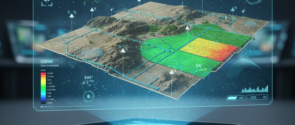
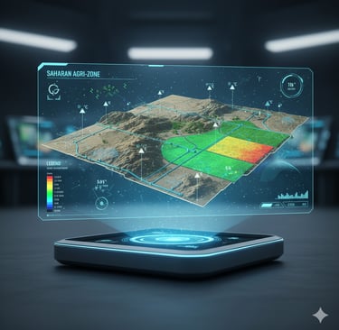
The Sensing Layer: A Multi-Scale Data Collection Network
The foundation of our intelligent water management system is a multi-layered sensor network, designed to capture a comprehensive, real-time picture of the entire hydrological and meteorological state of the reforested Sahara.
The Subsurface Layer (In-Situ Soil Sensors):
Technology: A dense grid of wireless, self-powered soil moisture sensors would be deployed across all agricultural and afforestation zones. These sensors, likely based on Time-Domain Reflectometry (TDR) or Frequency-Domain Reflectometry (FDR), provide highly accurate, real-time measurements of volumetric water content at multiple soil depths.
Data Provided: This layer provides the most critical "ground truth": exactly how much water is present in the root zone of the plants at any given moment.
Additional Sensors: These sensor nodes would also include probes for soil temperature and electrical conductivity (EC), providing data on root zone temperature and, crucially, tracking the buildup of soil salinity.
The Surface Layer (Automated Weather Stations):
Technology: A network of automated agrometeorological weather stations would be distributed throughout the landscape. Each station would be equipped with sensors to measure key atmospheric variables.
Data Provided:
Solar radiation (pyranometer)
Air temperature and relative humidity (hygrothermometer)
Wind speed and direction (anemometer)
Precipitation (rain gauge) - critical for tracking the success of the biotic pump
Barometric pressure
Function: This data is used to calculate the reference evapotranspiration (ET0), a standardized measure of the atmosphere's evaporative demand. This tells us how "thirsty" the atmosphere is on any given day.
The Canopy Layer (Plant-Based Sensors):
Technology: For high-value agricultural zones, we can go a step further and monitor the plants directly. This includes infrared thermometers to measure leaf canopy temperature (a proxy for water stress) and dendrometers to measure micro-variations in stem diameter, which can also indicate plant water status.
Function: These sensors provide direct physiological feedback from the plants themselves, allowing the system to detect the onset of water stress before it becomes visually apparent or causes yield loss.
The Aerial Layer (Satellite and Drone Imagery):
Technology: A constellation of dedicated remote sensing satellites, supplemented by fleets of autonomous drones, would provide a landscape-scale perspective.
Data Provided:
Normalized Difference Vegetation Index (NDVI): A measure of plant greenness and vigor, indicating overall ecosystem health.
Thermal Infrared Imagery: Used to map land surface temperature. Patches of hotter land can indicate areas where plants are water-stressed and not transpiring effectively.
Hyperspectral Imagery: Can detect subtle changes in the spectral signature of plants, which can be correlated with nutrient deficiencies, disease, or water stress.
Microwave Sensing: Satellites equipped with active microwave sensors (radar) can measure soil moisture over large areas, providing a crucial link between the point-data from in-situ sensors and the overall landscape.
The Intelligence Layer: The AI-Powered Control System
The raw data from this vast sensor network is meaningless without a system to process, analyze, and act upon it. This is the role of the central AI water management system.
Data Fusion: The AI's first task is to fuse the multi-scale data into a single, coherent digital model of the entire Saharan ecosystem. It combines the precise, high-frequency data from ground sensors with the broad, lower-frequency data from satellites.
Predictive Modeling: The AI runs a suite of complex, coupled models:
Weather Prediction Models: High-resolution numerical weather prediction (NWP) models to forecast temperature, rainfall, and solar radiation for the coming hours and days.
Crop Growth Models: Sophisticated models that simulate the growth of each specific crop, predicting its water needs based on its current developmental stage (phenology).
Soil-Water Balance Models: These models take the soil type, current moisture level, and predicted weather to calculate a continuous water balance for every "pixel" of the landscape, predicting when the soil moisture in the root zone will drop to a critical threshold (the "management allowable depletion" level).
Prescriptive Irrigation Scheduling: This is the core function. The AI does not operate on a fixed schedule. Instead, it generates a dynamic, prescriptive irrigation plan for the next 24-48 hours. For each individual irrigation zone (which could be as small as a single row of trees), the AI determines:
IF irrigation is needed: Based on the soil-water balance model, has the moisture level reached the trigger point?
WHEN to irrigate: It might schedule irrigation for the early morning or late evening to minimize evaporative losses.
HOW MUCH water to apply: It calculates the precise volume of water needed to return the root zone to its optimal moisture level (field capacity) without over-saturating the soil or causing excessive deep percolation.
System Control: The AI's decisions are then translated into commands sent to the automated control systems of the water grid. It opens and closes valves, adjusts pump speeds, and directly controls the drip irrigation network with no human intervention required for routine operations.
The Feedback Loop and System Learning
The system is not static; it is designed to learn and improve over time.
Real-Time Feedback: The sensor network provides continuous feedback on the results of the AI's irrigation decisions. Did the soil moisture return to the predicted level? Did the plant stress indicators (canopy temperature) decrease as expected?
Machine Learning: The AI uses machine learning algorithms to compare its model predictions with the real-world outcomes. Over time, it refines its models, learning the specific hydrological properties of different soil zones and the precise water use patterns of the developing ecosystems. It learns which areas dry out faster, which crops are more sensitive, and how to optimize water use with ever-increasing accuracy.
Leak Detection and Diagnostics: The AI constantly monitors the pressure and flow rates throughout the thousands of kilometers of pipelines. By comparing expected flow with actual flow, it can instantly detect anomalies that indicate a leak, automatically isolate the affected pipeline section by closing valves, and dispatch a robotic or human maintenance crew to the precise GPS coordinates of the suspected breach.
Conclusion: From Irrigation to Precision Hydration
The high-tech water management system for the Sahara represents the pinnacle of data-driven agriculture and environmental management. It elevates the concept of irrigation from a blunt instrument to a form of precision hydration. By creating a comprehensive "digital twin" of the Saharan ecosystem—sensed at every level from the deep soil to the satellite—and empowering an AI to manage it, we can achieve a level of water use efficiency that is simply unattainable with conventional methods.
This system is the key to the long-term sustainability of the project. It ensures that our most precious, artificially-generated resource is used with maximum intelligence and minimum waste. It allows us to support a continent-scale ecosystem with a finite water budget. It is the brain and nervous system that animates the vascular network of the water grid, making the vision of a green Sahara not just possible, but sustainable.
Having detailed the technological heart of our agricultural systems, our next lectures will explore the human and societal dimensions of this transformed landscape. Thank you.