Add your promotional text...
Lecture 3: The Water Source II: Reviving Ancient Aquifers
Series: The Sahara Reforestation Project: From Dune Sea to Green Valley Part I: The Foundation - Analysis and Initial Interventions (Lectures 1-10)
3/4/20266 min read
Introduction: The Subterranean Oceans
Welcome. In our previous lecture, we detailed the immense technological undertaking of generating a new water supply for the Sahara via mega-scale desalination. This approach provides a theoretically limitless, albeit energy-intensive, source of freshwater. However, an equally vast, and in some respects more tantalizing, water resource already exists, hidden deep beneath the desert sands: the great fossil aquifers of North Africa. These are not renewable rivers, but subterranean oceans of ancient water, sequestered for millennia.
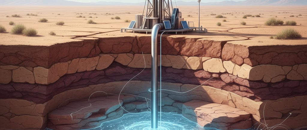
This lecture will shift our focus from manufacturing new water to mining old water. We will explore the geology and hydrogeology of the two most significant systems: the Nubian Sandstone Aquifer System in the east and the North-Western Sahara Aquifer System. We will analyze the volume and age of these reserves, the critical concept of "fossil" water, and the complex technical and ethical questions surrounding its extraction. Our discussion will cover the determination of sustainable (or, more accurately, managed) extraction rates, the significant risks of depletion and land subsidence, and the geochemistry of this ancient water, which is far from pure and may require substantial treatment before it can be used to seed a new biosphere.
Geological Context: The Formation of a Fossil Aquifer
To understand Saharan aquifers, we must first understand their geological vessel. An aquifer is a body of porous and permeable rock or sediment saturated with groundwater. The great Saharan aquifers are primarily composed of thick layers of sandstone deposited over hundreds of millions of years, from the Paleozoic to the Mesozoic eras, when North Africa was a landscape of vast river systems, deltas, and shallow seas. These sandstone layers, interspersed with impermeable layers of shale and clay (aquitards), form a complex, multi-layered "sandwich" of rock.
The water itself is termed "fossil water" or "paleowater." It is not a product of modern rainfall. This water primarily infiltrated the ground during past climatic periods of significantly higher precipitation, most notably during the interglacial periods of the Pleistocene and the African Humid Period of the Holocene, which we discussed in Lecture 1. During these "Green Sahara" periods, rainfall was abundant, feeding rivers and lakes that saturated these vast sandstone formations. When the climate shifted back to hyper-aridity, this water was trapped underground, sealed off from the dry surface by impermeable layers, creating a finite, non-renewable resource on human timescales. Radiometric dating (using isotopes like Carbon-14 and Chlorine-36) has confirmed the age of this water, with some samples dating back over a million years.
The Nubian Sandstone Aquifer System (NSAS): A Giant in the East
The Nubian Sandstone Aquifer System is one of the largest known fossil aquifers in the world, underlying nearly 2.2 million square kilometers of Egypt, eastern Libya, northeastern Chad, and northern Sudan. It is a transboundary resource of immense geopolitical significance.
Structure and Volume: The NSAS is a multi-layered system, with water-bearing sandstone formations (the "Nubian Sandstone") reaching thicknesses of up to 3,500 meters. The total estimated volume of stored groundwater is staggering, on the order of 150,000 cubic kilometers (150 trillion cubic meters). To put this in perspective, this is equivalent to roughly 200 years of the entire Nile River's annual discharge. However, only a fraction of this volume is economically extractable.
Hydrogeology: The aquifer is largely "unconfined" in the south (the recharge zone, where it is exposed at the surface) and becomes "confined" as it deepens to the north, trapped beneath impermeable layers. The water flows with an extremely slow hydraulic gradient, generally from its ancient recharge zones in the south towards its discharge zones in the north, such as the Qattara Depression in Egypt. The timescale of this natural flow is on the order of thousands to tens of thousands of years.
Existing Exploitation: The NSAS is already being tapped, most famously by Libya's "Great Man-Made River Project," a massive network of pipelines that extracts fossil water from the southern desert to supply coastal cities and agriculture. Egypt also utilizes the NSAS for its "New Valley Project" to develop agriculture in desert oases. These projects provide a real-world case study in the engineering of fossil water extraction.
The North-Western Sahara Aquifer System (NWSAS): A Complex Western Counterpart
To the west, underlying Algeria, Tunisia, and parts of Libya, is the North-Western Sahara Aquifer System. Though smaller than the NSAS, it is an equally critical resource.
Structure and Volume: The NWSAS covers approximately 1 million square kilometers and is composed of two main superposed aquifer layers: the shallow "Complexe Terminal" (CT) and the deeper "Continental Intercalaire" (CI). The total stored, non-renewable volume is estimated at around 30,000 cubic kilometers.
Hydrogeology: The system is geologically more complex than the NSAS, with more faulting and variation in layers. The recharge zones are primarily in the Atlas Mountains to the north, where modern rainfall does provide a very small, almost negligible, amount of annual recharge compared to the vast fossil reserves.
Challenges of Over-exploitation: The NWSAS is already under significant stress, with thousands of wells in Algeria and Tunisia extracting water for agriculture and domestic use. This has led to measurable drops in the piezometric head (water pressure), the drying up of natural springs and oases, and increasing concerns about long-term sustainability. The situation highlights the critical need for coordinated, transboundary management.
Extraction Strategy: Managed Depletion vs. Sustainability
The term "sustainable extraction" is a misnomer when dealing with fossil water. As the resource is non-renewable on human timescales, any extraction is, by definition, a form of mining. A more accurate term is "managed depletion." The strategic goal for the Sahara Reforestation Project is not to preserve the aquifers indefinitely, but to use a calculated portion of their volume as a "bridging resource"—a critical water supply during the initial centuries of terraforming while the new, biologically driven water cycle is being established.
Determining the extraction rate is a complex optimization problem, balancing the immediate needs of the project against the long-term consequences of depletion. This requires sophisticated hydrogeological modeling, considering:
Piezometric Drawdown: How will pumping at one location affect water levels and pressure across hundreds of kilometers?
Well Interference: How do multiple extraction wells interact with each other?
Land Subsidence: The removal of vast volumes of water from porous rock can lead to the compaction of the aquifer system, resulting in the gradual sinking of the land surface. This can damage infrastructure and alter surface hydrology.
Ecological Impact: The depletion of aquifers can lead to the drying up of the last remaining natural oases, which are invaluable hotspots of existing biodiversity.
A plausible strategy would involve a zoned approach: intensive extraction in targeted, geologically stable interior regions designated for the first agricultural zones, while establishing strict conservation zones around existing oases and known discharge areas. The extraction rate would be dynamically managed by the AI-powered water grid (discussed in a future lecture), constantly adjusting based on real-time data from a network of monitoring wells.
The Geochemistry of Paleowater: Treatment Requirements
A common misconception is that this ancient, pristine water is ready to use. While it is free of modern anthropogenic pollutants, its long residence time in deep rock formations means it has reached geochemical equilibrium with its host rock, resulting in high concentrations of dissolved minerals. The water chemistry varies significantly across the aquifers, but common issues include:
High Salinity: While much fresher than seawater, the total dissolved solids (TDS) can still be high, often ranging from 500 to 2,000 ppm, and sometimes much higher in deeper or more stagnant zones. This level of salinity is unsuitable for many standard crops and would require treatment.
Hardness: High concentrations of dissolved calcium and magnesium make the water "hard," which can cause scaling in pipes and irrigation equipment.
Dissolved Minerals: The water is often rich in iron, manganese, and sulfur compounds (giving it a characteristic odor). When exposed to air, dissolved iron and manganese can oxidize and precipitate, clogging irrigation systems.
Radioisotopes: The long interaction with sandstone and underlying granitic basement rock can lead to elevated levels of naturally occurring radioactive isotopes, such as Radium-226 and Radon-222, which may need to be addressed for human consumption.
Anoxic Conditions: The water is typically anoxic (lacking dissolved oxygen), which can affect its interaction with soil and plant roots.
Consequently, large-scale treatment will be necessary. This would not be as energy-intensive as seawater desalination, but would still require significant infrastructure. A typical treatment train might involve:
Aeration: To oxidize and precipitate dissolved iron and manganese.
Filtration: To remove the precipitated solids.
Brackish Water Reverse Osmosis (BWRO): For regions where salinity is too high for direct agricultural use. BWRO operates at much lower pressures (15-25 bar) than SWRO, making it significantly more energy-efficient.
pH Adjustment and Disinfection: Final steps to prepare the water for the distribution grid.
The brine produced from BWRO would also need to be managed, potentially by injecting it into deep, isolated saline aquifers or using it to create managed salt-marsh ecosystems.
Conclusion: A Finite but Critical Bridging Resource
The fossil aquifers beneath the Sahara represent a water reserve of planetary significance. While their extraction is a process of managed depletion, they are an indispensable resource for the initial, most critical phases of the Sahara Reforestation Project. They offer a less energy-intensive alternative to desalination for supplying the first inland agricultural zones and can provide the vast quantities of water needed to establish the initial pioneer forests before a self-sustaining water cycle takes hold.
However, their use is fraught with technical, environmental, and geopolitical challenges. The hydrogeological system must be modeled with unprecedented accuracy to manage drawdown and prevent subsidence. The water itself requires tailored geochemical treatment before use. Most importantly, the transboundary nature of these aquifers necessitates an unparalleled level of international cooperation to ensure their managed depletion does not lead to conflict.
Having now established our two primary water sources—the "infinite" but energy-intensive coastal desalination plants and the "finite" but geographically distributed fossil aquifers—we are prepared to address the next monumental challenge. Our next lecture, "The Water Grid: A Continental Plumbing System," will detail the engineering of the vast network of pipelines and canals required to transport this water from its source to where it is needed most: the barren heart of the desert. Thank you.